Are you aware of these challenges?
Your communication with everyone involved is very laborious.
They have no overview of important tasks and coordination is difficult.
Your contact details are not summarized in any system.
Calamities require clever decisions and actions.
Their forest plots are parceled out and not clearly laid out.
They have more and more tasks, but too few people to carry them out.
“Enabling digital forms of work
Time savings: Previously one letter per day is now
a reminder via notification in seconds.
WoodsApp optimizes your communication and
significantly increases your efficiency!”
Synergies in forestry and IT
WoodsApp is the result of these two industries. By combining our digital know-how with forestry practice, we offer you modern solutions that meet your current challenges
If you use WoodsApp, the following will change
Reach new members for your organizations and create transparency.
Take preventive action against calamities with comprehensive satellite data.
Keep an eye on all of your organization's tasks and coordination.
You have a daily overview of your forest and current vitality data.
Save time with efficient communication processes on one platform.
Provide clear task structures for employees and members.

Who is WoodsApp for?

Forest owner

Organisations

Service provider
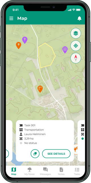
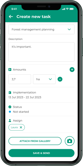
How does WoodsApp work?
Mobile app
The app shows your official forest parcels on a map and provides a direct link to the responsible forestry association.
Get feedback on observations in the forest and always receive the latest data from ESA satellites to detect forest damage at an early stage.
Web application
Comprehensive, up-to-date overview of all connected forest owners and their areas, communication option with forest owners directly from the application.
Sending push messages to selected groups or members of a region.
Powerful backend in the cloud
Topographic maps, aerial images, current satellite maps and background images from ESA combined with artificial intelligence for self-learning analyses for risk detection.
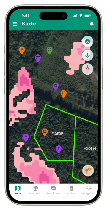
What can you find in the app?
My forest
- I can find my official parcels in WoodsApp
- Current satellite data shows the condition of my forest
- Notes on the map doucment my measures
My forester
- I communicate directly with my forester in the app
- Exchange of map notes shows what is happening on site
- My forester always keeps me up to date with important information
Always informed
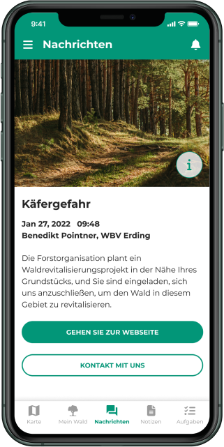
- Forestry news channel delivers customized news
- News about critical changes in my forest
- Forest owners and foresters always keep an eye on the forest
Test WoodsApp now for free!
Test 14 days free of charge.
Available throughout Germany and soon also in Austria
Find your piece of forest on the map and use our vitality map.